The split mountain and the concrete ruin: why only half of Sado's mining past is World Heritage
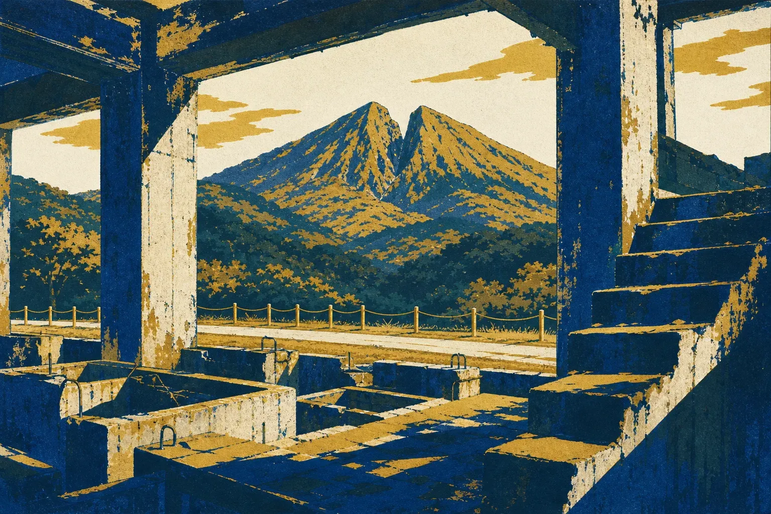
The most photographed ruin on Sado Island could once put 50,000 tons of ore a month through its flotation cells. The Kitazawa Flotation Plant, billed in its working life as the largest floating ore processing plant in the Orient, is now a hillside of stepped concrete foundations, a brick power house, and a great circular thickener that visitors keep comparing to the floating castle in a Ghibli film. Entry is free. It gets illuminated during the tourist season. It has its own bus stop, two minutes' walk away. And it is, quite deliberately, not World Heritage.
That was no oversight. In June 2024, ICOMOS, the advisory body that vets nominations for UNESCO, asked Japan to exclude the Kitazawa district from the proposed property. Japan agreed, and "Sado Island Gold Mines" was inscribed on 27 July 2024 as the country's 26th World Heritage site with the boundary drawn to leave the concrete out. The exclusion confuses nearly everyone who visits. It is also the single most useful thing to understand before you go.
What the boundary actually contains
The inscription rests on one criterion, number (iv), and one narrow claim: Sado demonstrates "the continuity of manual mining and smelting technology in a period when mechanisation was progressively being introduced elsewhere." While Europe was putting steam engines down its pits, the Tokugawa shogunate's miners were still splitting rock by hand, and they kept refining that handwork until it extracted high-purity gold at scale. The protected property accordingly covers the late sixteenth century to the mid-nineteenth. Nothing later qualifies.
Three named areas make up the serial property. Nishimikawa Placer Gold Mine, in the island's south, is where crews practiced ōgonagashi, washing entire hillsides away with water carried in through hand-dug channels; what survives are the excavation scars and waterways, plus terraces that farmers later reoccupied as rice paddies, which means part of this World Heritage site now grows rice. Tsurushi Silver Mine, found in 1542, is the elder underground operation. Its Ōtaki Mabu gallery survives, as do the Nishi-Ikari-michi and Tsurushi-michi mountain passes that linked it to Aikawa; the footpaths are inscribed too, because UNESCO was protecting a working landscape rather than a set of holes.
Aikawa Gold and Silver Mine is the third component and the center of gravity: a whole town's worth of tunnels, drainage works, temple districts and administrative remains above the Sea of Japan.
The mountain they broke by hand
Dōyū-no-Warito is Aikawa's signature, a summit cleaved into a V roughly 30 meters wide, 74 meters deep and 120 meters long by Edo-period opencast digging that chased the Dōyū lode straight down. No machines cut that upper cleft. The larger opening gaping below it belongs to a different era, blasted out with dynamite from Meiji times onward, and telling the two apart is half of what you are doing when you stand there. In February 2025 the hand-cut silhouette was adopted as the property's official logo, which tells you exactly where the inscribed value lies. Viewing is free, about five minutes on foot from the Sado Kinzanmae bus stop, though the classic close-up comes from inside the paid tunnel course (1,500 yen for adults as of 2026, no reservation needed), whose Dōyū route surfaces at the viewpoint beneath the split itself.
What made Sado extraordinary was less the digging than the organization around it. The shogunate ran the island directly, and the reconstructed Sado Bugyōshō, the magistrate's office (500 yen as of 2026, open 8:30 to 17:00), shows the whole chain in one compound, including the yoseseriba, the refining and assay works unique to Sado where ore became the metal for koban coins. At its Edo-period peak the mine yielded over 400 kilograms of gold a year, and Aikawa held some 50,000 people.
The landscape also records what that output cost. As shafts sank below the waterline, the shogunate conscripted mushukunin, registered vagrants rounded up in Edo, Osaka and Nagasaki, to work as drainage laborers; roughly 1,800 were shipped over. Fifteen minutes' walk uphill from the bus stop, past where the crowds thin out, a gravestone commemorates 28 of them killed underground in 1853. Drainage works like the Minamisawa tunnel are part of the inscribed property. The graves are the other half of that entry.
There is a newer chapter, outside the inscribed period but not outside the story. Korean workers were recruited to the modern mine from February 1939, about 1,200 arriving by 1945, and inscription went ahead only after Japan undertook to present the site's full history. An exhibit on the lives of mine workers, including those from the Korean Peninsula, opened at the Aikawa Local Museum on 28 July 2024, the day after inscription. Memorial ceremonies followed in November 2024 and September 2025; South Korea attended neither, and whether the display says enough remains disputed. Visit it anyway, and treat it as a memorial rather than a stop on a circuit.
Mining money built gentler things too. Kasuga Shrine was founded in 1605 by Ōkubo Nagayasu, a Noh actor who became the shogunate's deputy on Sado, and its Noh stage tradition dates from 1645. The island's unusual density of Noh stages is a direct byproduct of gold.
The concrete half, and how to read both
None of which makes Kitazawa unimportant. It and Ōdate Tateko, Japan's oldest Western-style vertical shaft, sunk from 1875 under German engineers and finished in 1877 at 352 meters deep, are protected as National Historic Sites under Japanese law. They are simply evidence for a different argument, the story of Meiji industrialization, and including them would have blurred the precise claim that got Sado inscribed. Be aware that Ōdate Tateko is currently sheeted over for construction work and cannot be viewed, so save yourself the eight-minute walk for now.
A workable order for seeing both halves in a day: the Kirarium Sado guidance center in Aikawa first (exhibition 300 yen as of 2026, about 30 minutes), because it is the difference between walking through scenery and reading it; then the inscribed tunnels and the magistrate's office while the light is high; then Kitazawa at the end of the day. Since spring 2026 the mine's shop and reference room have been down in the Kitazawa district anyway, so you will end up among the concrete whether you planned to or not. If the seasonal illumination is running, stay until the floodlights come up over the thickener. What everyone is photographing is the machine age that ended Sado's hand-worked story, still standing over the town it fed. The boundary UNESCO drew takes nothing away from it. It just tells you which century you are looking at.